| Location | Philadelphia, PA |
| Date | Fall 2014 - 2016 |
| Principals | Karen M’Closkey + Keith VanDerSys |
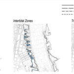
Philadelphia, like many cities that have shifted to a service economy, is reinventing its waterfronts. A series of recent planning and regulatory initiatives are underway, which aspire to transform the Delaware River from a transportation utility into an ecological and recreational resource (i.e. Green City, Clean Waters; Master Plan for the Central Delaware; Estuary Restoration Act). This transformation will require remaking miles of armored river edges into “living shorelines” and manufacturing vast acreages of tidal wetlands. While greening proposals abound within the redesign of shorelines and waterways, two of the most important factors for gauging wetland suitability–energy and elevation data–are typically absent in these re-natured visions. This disregard for the key parameters of living edges has greatly limited landscape architects’ abilities to effectively imagine strategies for working with the dynamics of our urban waterways.
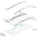
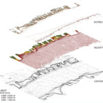
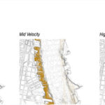
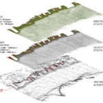
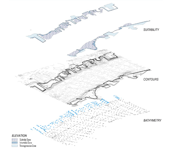
Our project, Testing the Waters, explores wetland suitability strategies that are directly guided by energy and elevation parameters, collected and modeled by us, through the computational capacities of geospatial analysis (GIS), computational flow dynamics (Aquaveo SRH-2D), and parametric software (Grasshopper). There are two primary challenges when integrating hydrodynamic simulation into design methods: reliable data; and platform interoperability. First, much of the data available for waterways are too coarse, outdated, or altogether absent, since they are mapped primarily for navigation purposes. For example, a comparison of the geospatial data (topography and bathymetry) available through PASDA, NOAA, and USACE, shows that the shoreline information is missing. This is not unique to the Delaware River; these information gaps are characteristic of many urban rivers. This leaves data collection up to designers, which we achieved by attaching a GPS /depth-finder (Lowrance Mark-4 HDI) to a remote-controlled bait boat.