National ASLA Honor Award: Analysis and Planning, WLA Professional Awards- Analysis and Planning, Honorable Mention
| Project | UAV Shoreline Mapping |
| Location | San Cristobal, Galapagos |
| Date | Summer 2019- |
| Principals | Karen M’Closkey + Keith VanDerSys |
| Client | INOCAR, The Charles Darwin Foundation |
| Collaborators | Michael Luegering, Michael Tantala, Michael Weisberg |
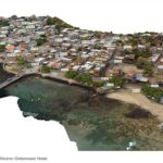
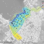
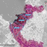
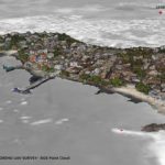
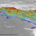
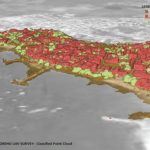
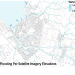
We have been working with students in the Galápagos Islands on projects that relate to the growth of Puerto Baquerizo Moreno on San Cristóbal Island. One of the issues we found was a mismatch between land and water elevations – information that would facilitate reconfiguring this zone to improve the conditions related to the conflicting uses among people and animals, as well as provide the base model for sea-level rise (SLR), storm-surge, and tsunami modeling.
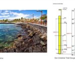
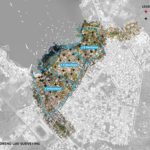
The archipelago’s tidal gauges lack a consistent and unified vertical datum. Without this benchmark, tides cannot be accurately referenced to the land, making past analysis and future projections impossible. INOCAR (the Ecuadorian Navy) requested our assistance in data collection and modeling. Using UAV technology and GNSS/GPS survey equipment, we mapped and modeled Puerto Baquerizo Moreno’s shoreline, including the tidal gauge location. The georeferenced data will enable INOCAR to establish an accurate topo-bathy model and unified vertical datum among the islands’ tidal gauges. This information will assist with SLR and tsunami modeling and assess the potential impact on the town urban growth as its population continues to grow.