| Project | Pattern finding to evaluate vacant site criteria for maintenance and infiltration strategies |
| Location | Philalephia, PA |
| Date | 2009- present |
| Client | Self-initiated research |
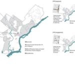
| Collaborators | The Pennsylvania Horticultural Society, the Redevelopment Authority of Philadelphia, the Philadelphia Water Department, and Asociacio de Peutorriquenoes en Marcha for Everyone |
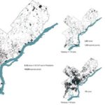
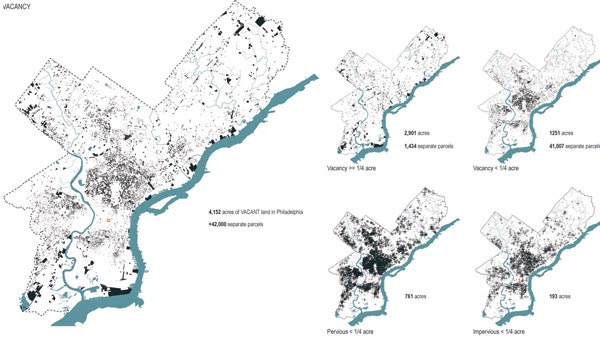
Philadelphia has over 40,000 vacant properties, of which 9,000 are city owned. In response to this, we initiated and built a series of research projects, with governmental and non-profit alliances, which explore the potential of low-cost engineering substrates as a means to address two key issues of vacancy: maintenance and infiltration.
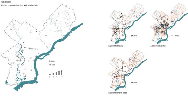
Philadelphia Mayor Nutter’s administration has made sustainability a priority with the recently created Office of Sustainability. As part of this, two recent initiatives-Green 2015 and Green City, Clean Waters-aim to transform vacant, publicly and privately-owned land into recreation and infiltration areas. The first seeks to extend the successes of the Pennsylvania Horticultural Society’s Clean and Green program to provide 500-acres of new parks. The latter targets vacancy as a land-based stormwater management strategy to reduce runoff and pollutants associated with sewer overflows that are common to Philadelphia’s overburdened combined sewer system.
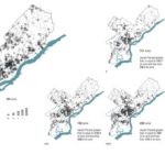
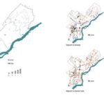
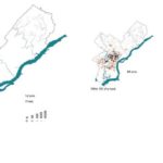
Both strategies target vacant lots that are 1/4-acre or larger; a parcel size that comprises seventy percent of the 4,152 acres of total vacant land. The remaining parcels, which comprise 1,251 acres, are under 1/4-acre each. These sites of ‘micro-vacancy’ are too small for typical land banking or recreational space strategies that require large-scale administrative oversight.
The drawings were used to develop site selection criteria to prioritize the best locations for specific, site-based installations. This is not a master-plan proposal. The vacancy is extensive and cannot be dealt with in totality or under a single administrative entity; however, these maps provide a series of layers (looking at the intersections among multiple factors) that can facilitate selecting target areas for “incremental” infrastructures.